The bar has been raised
Across Europe, regulators and grid operators are dismantling “first-come, first-served.” Great Britain has already done it: under NESO’s Gate 2 criteria, a firm connection requires secured land rights and planning progress. Germany’s transmission operators introduced a maturity-based procedure, the Reifegradverfahren, in April 2026, with legislation to formalise it now in the Bundestag. Poland’s Grid Act has been in force since April and halved the validity of connection conditions to twelve months. France’s Senate has voted to move to premier prêt, premier servi. These reforms are shifting the incentives even more in favour of de-risking projects as early as possible.
It’s no longer land first. It’s grid first, and permitting risk is now grid risk too: a delay in consenting can cost you your place in the queue.
Starting with the right site is critical to securing permits, grid connection and financing, but finding land that checks every box gets more and more difficult as your criteria tighten. Until now, developers faced a trade-off:
- High-precision local screening: Limit your search to a small geographic area, leaving you guessing what you missed elsewhere.
- Staged regional screening: Run a broad, low-constraint search over a large area, then manually evaluate candidate sites one by one. This forces you to accept site flaws late in the process or start over entirely.
Either way, it’s time-consuming and, more importantly, you risk missing better sites.
What if you could screen an entire country against all your grid, permitting and technical constraints at high resolution, in just minutes, letting you iterate until you’re certain you’ve found the sites that best suit your criteria?
That is Land Screening.
How it works
Select your target region, load your custom constraint profile, and hit run. Most teams start with grid constraints such as proximity to MV grid, private substations and curtailment risk, then layer on protection zones, zoning, detailed topography and more. Grid, permitting and technical risk get screened in one pass.
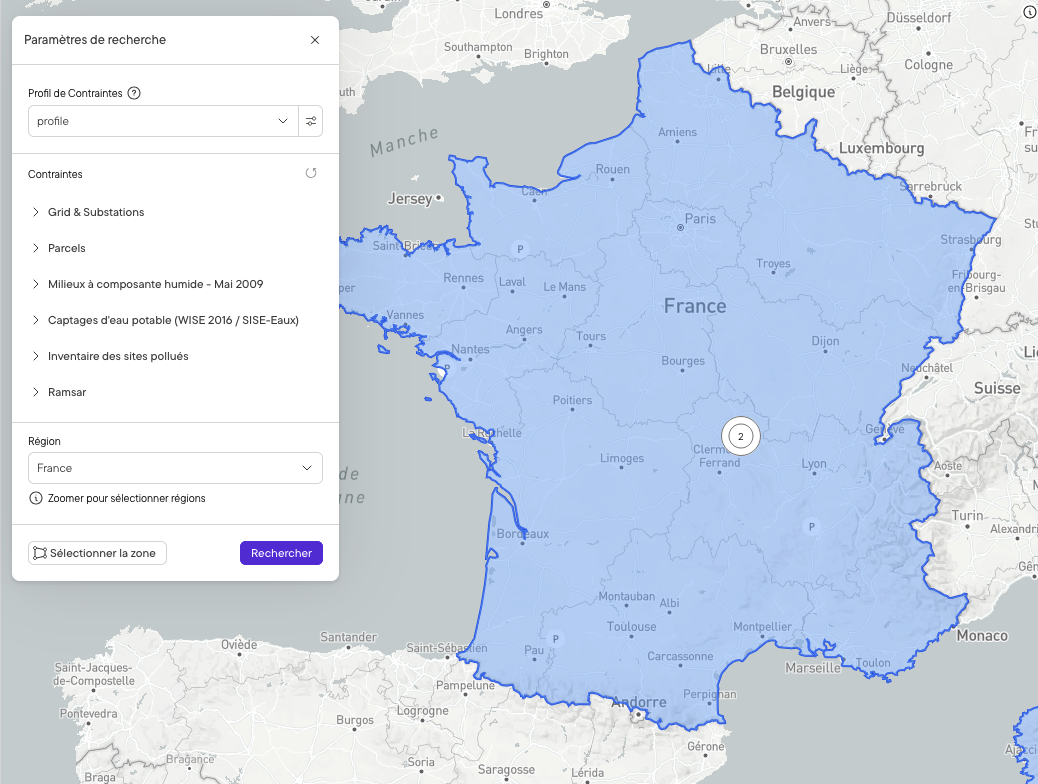
Grab a coffee. Within minutes, Land Screening returns a list of opportunity areas that you can filter and rank by buildable area and parcel count.
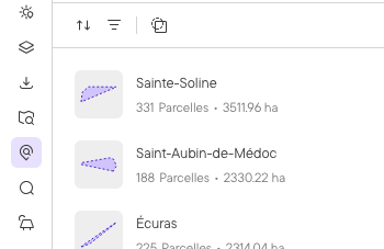
If your search yields zero results, you know immediately that your dream site doesn’t exist anywhere in that country, under those constraints. Adjust your non-critical constraints, re-run, and compare. Within a few iterations (hopefully few since too much coffee is not good for you), you hold a refined shortlist of opportunity areas.
No surprises when you zoom in
Screening tools usually trade resolution for coverage. That trade-off is why a clean-looking screening result can still fall apart later: you request ownership information, wait weeks for it to come back, and only then find the setback or protected area the screening never caught.
Land Screening runs the same constraint layers as Buildable Area. The buildable area you see on a parcel in your results is close to what you get when you open that parcel and run the full analysis. The shortlist you take into landowner outreach is a shortlist you can act on.
Two tools take it from there, and they answer different questions. Area Insights gives a status for every constraint layer on a shortlisted area, cleared, caution or danger, with dedicated slope and parcel sections. Buildable Area turns the same constraint profile into the precise buildable footprint once you decide to pursue an area.
Create a project or export to CSV
Inspect your opportunity areas, select individual parcels, or pull entire regions directly into a Glint project for layout design and yield simulations. You can also export parcel details directly to CSV, ideal for submitting ownership information requests.
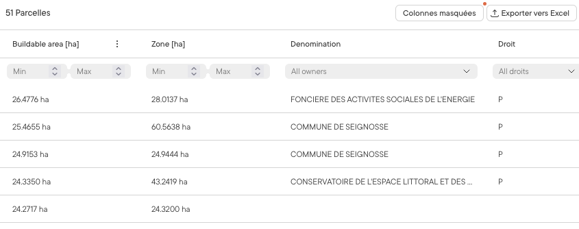
Which markets does Land Screening support?
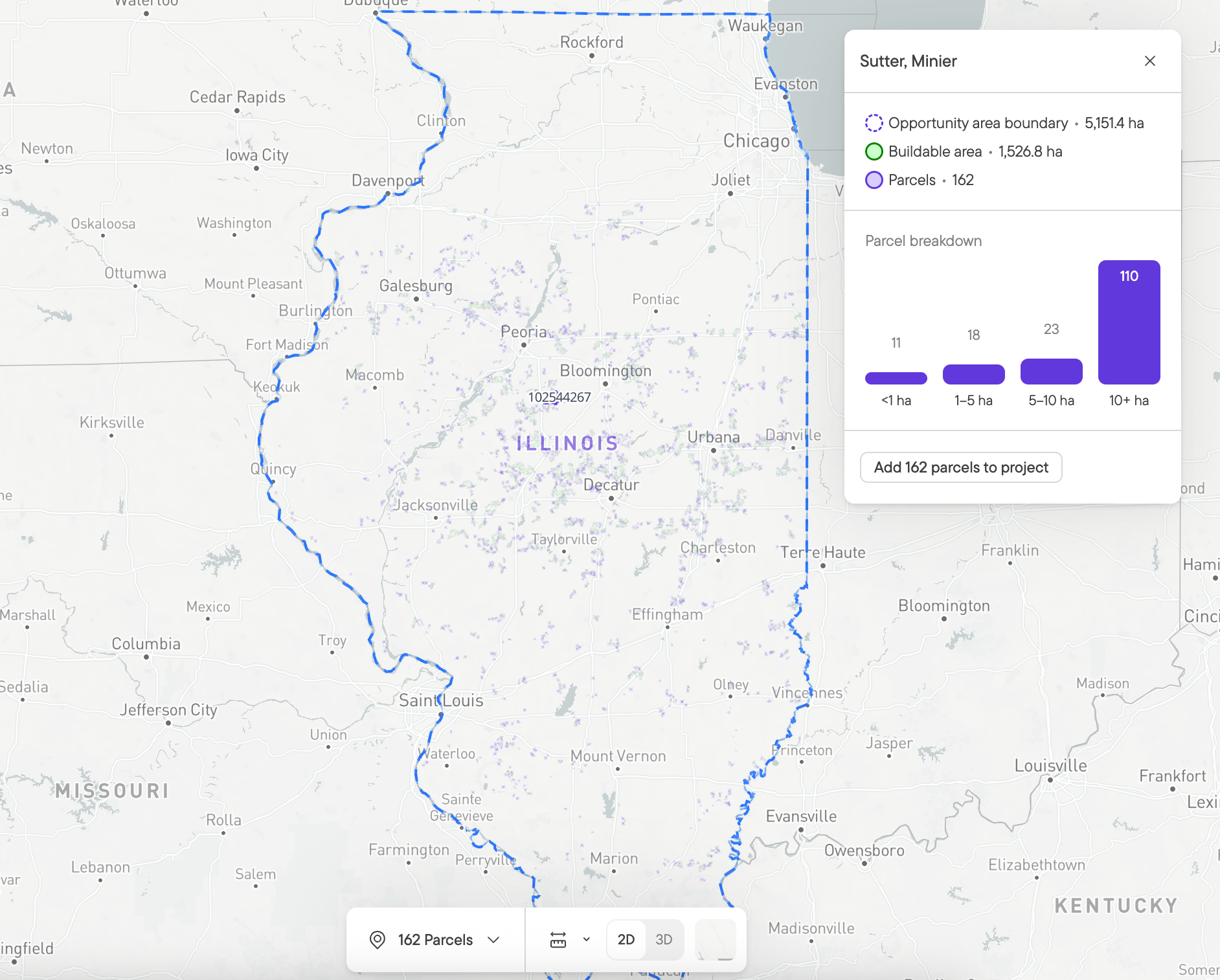
Land Screening is currently available in selected States (Illinois, New York, Pennsylvania, Virginia, Maryland and Texas) as well as France and Germany. More States and European countries are planned soon.
Want to learn more? Get in touch with our team today.
/Everything%20You%20Need%20To%20Know%20About%20Battery%20Energy%20Storage%20Systems%20(BESS)%20Thumbnail%20(1).png)