One platform, five stages: how Solkraft Sør rules out risk before it costs them anything
Nikolai Bjørnsen screens ten sites to keep one. Sometimes two. The rest are gone before anyone has spoken to a landowner or paid a consultant.
The short version
The method is subtraction. A connection point within 500 metres of a 22 kV line, then a constraint list strict enough that ten candidate sites leave one or two standing. Whatever survives runs through the same five stages, and all five happen inside one Glint Solar project.
Solkraft Sør develop utility-scale PV with co-located batteries in Agder, southern Norway: 24 projects in active development, 265 GWh of annual production in the pipeline, run by a core team of three.
Nikolai is Head of Project Development at Solkraft Sør. He walked Even Kvelland, co-founder and Chief Commercial Officer at Glint Solar, through the whole method in an on-demand session recorded on 20 August 2026. That included a live walkthrough of a project sitting in a hearing right now.
The rule about walking away
Every project at Solkraft Sør runs through the same siting strategy before anyone talks to a landowner. Rule a site out early, and the ones that survive are worth the time the next four stages take.
"It is as important to rule out projects as it is to take projects forward."
Nikolai Bjørnsen, Head of Project Development, Solkraft Sør
From the recording, 09:41
Nikolai on the siting strategy, and why ruling a project out counts for as much as taking one forward. Watch the full session
Every project is built on that strategy. If a site doesn't follow the criteria, it doesn't get developed any further, and there's no discretion in it.
It's also how a core team of three runs 24 projects at once. Solkraft Sør started with two people and added a third last year, and developers of a similar size in Norway run teams of 10 to 20. Nikolai treats the small team as the strategy rather than a phase to grow out of: "When you are more people, you have a lot more people that are going to do the same type of things." Grid applications, zoning and environmental impact assessment all sit with external partners the team works alongside, rather than being brought in-house.
All 24 are designed and live in Glint Solar, PV and battery together in each project, which is what keeps a portfolio that size legible to three people. But software only helps if the pipeline going into it is honest. That arithmetic holds because the team almost never spends an hour on a project that was never going to happen, and the siting strategy is what does that work early.
The connection point is the first test
Norwegian distribution capacity is close to full in most places, so Solkraft Sør look for the holes in it rather than for good ground. They start on the 22 kV lines, filter a 500 metre corridor either side, and look for mountainous tops inside that corridor.
From the recording, 30:26
Nikolai turns on the grid layer in Glint Solar, filters the 500 metre corridor either side of the 22 kV lines, and starts looking for mountainous tops inside it. Watch the full session
Two more things have to coincide before the site is worth a second look. An existing road good enough to use without blasting into the mountain, and a single landowner rather than several, which keeps the land lease and the permitting phase clean.
Getting all three at once is rare. As Nikolai puts it, it's difficult to have the grid line near, all of these constraints around, and also an existing road you can actually use. That rarity is the point. The sites that clear it are realistic, and everything the team then presents to a municipality or to the state is a project that could genuinely be built.
Starting at the connection point rather than at the irradiance is a pattern we see across markets. It's the same logic behind grid-first site prospecting, and in the Nordics specifically it's shaped by how the regional grid system allocates capacity.
What gets a site struck off
The criteria are checked in the map before anything is drawn. Every one of them has to clear.
| Criterion | What it decides |
|---|---|
| HV grid and distance | A connection point inside a 500 metre corridor along a 22 kV line. Without one, nothing else gets assessed. |
| Municipal plan and zoning | Whether the land use in force allows the project to be applied for at all |
| Cultural heritage | Registered heritage in the area rules the site out |
| Nature types and species | Protected habitat or a species of concern is a no |
| Outdoor recreation | Land in active recreational use creates exactly the conflict the strategy exists to avoid |
| Terrain and slope | Flat ground, or a gentle fall towards the south. Steep sites are dropped |
| Irradiance | Whether the yield justifies everything that follows |
| Land use on the ground | No productive forest, no farmland, no wetland |
| Landowners | One owner across the buildable area, rather than several |
| Road access | An existing road usable without blasting |
Ten sites go into that filter and one or two come out. A list this strict reads like it should starve the pipeline, and it does the opposite. Solkraft Sør are deliberately building on land nobody is fighting over.
"We are trying to build these plants on areas that are zero conflict zones. If you add more constraint layers, essentially there is no available options."
Nikolai Bjørnsen, Solkraft Sør
From the recording, 36:52
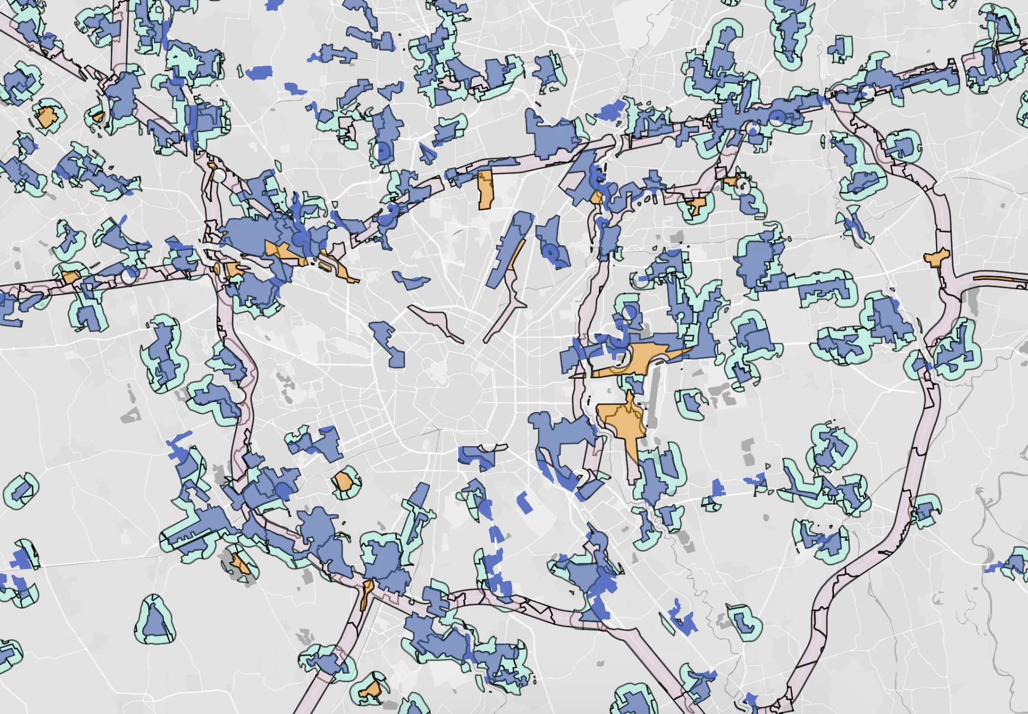
The constraint stack on a live project in Glint Solar. Red, blue and orange are all land the layout is not allowed to touch. Watch the full session
The farmland exclusion is worth pausing on, because it's the opposite of the direction much of Europe has taken. Agrivoltaics is the sanctioned route in France and Italy. In Norway, farmland projects draw objections from locals, municipalities and politicians alike, so Solkraft Sør don't attempt them. Ruling out the contested land up front means fewer sites survive screening and more of the survivors get permitted.
The five stages a surviving site runs
Sites that clear the filter go into the same sequence every time, and it runs in one workspace from screening through to the grid application. Each stage has a gate, and a project that fails one doesn't advance to the next. Solkraft Sør label each stage twice on their own slide: what happens, and what they do in Glint Solar to make it happen.
It's what Solkraft Sør call their five-stage engine. The same map that ruled a site out becomes the pre-design layout in minutes rather than months, so a candidate can move straight from screening into a first design instead of waiting on a separate CAD pass. That speed is what makes it possible to hold the same discipline across a whole portfolio, not just the one project in front of you.
Stage 01
Screening
Map layers filtered against the siting strategy to find and narrow candidate areas.
In Glint Solar map layers for nature, heritage, zoning and grid.
Continues if the site clears every criterion.
Stage 02
Pre-design
A first layout. Panel fields, roads, the HV substation, battery containers, 3D dimensioning.
In Glint Solar polygons, 3D objects, dimensioning.
Continues if the plant fits inside what the exclusion zones leave.
Stage 03
Engagement
Landowner first, then the municipality, the politicians and local organisations.
In Glint Solar lease plots, Beautify renders, map figures.
Continues if a landowner is ready to sign a land lease, and local support holds up.
Stage 04
Redesign
A site visit, then the layout reworked against what the ground actually shows.
In Glint Solar the same polygons and 3D objects again, plus real-world GPS points imported from the visit.
Continues if the project still stands up once reality has checked the map.
Stage 05
Application
Grid connection application, then permitting through the municipality or through NVE at state level.
In Glint Solar exports of shapefiles, site plans and analyses.
Continues if the permit is granted.
Notice where the landowner conversation sits. It's stage three, after the map has already thrown out eight or nine candidates, which means the expensive and slow parts of development only ever run on sites that have earned them.
The sequence also loops. Findings from the EIA and the hearing rounds feed straight back into stage four. And because the geometry is already in the project, a redesign is a new version of the same site rather than a fresh start. That continuity is the part a folder of exported files can't give you.
Sandripheia, and what changed in the room
Sandripheia Solar and Battery Park sits in Vennesla municipality. 4.5 MW of PV with a 4 MW / 8 MWh battery, around 5.6 GWh a year, connected to the local 20 kV network, with a large transformer station nearby. The team has been working on it for close to three years and expects a permit late this year or early next.
On 13 August they held a public meeting at the local town hall while the first hearing round was still open. Instead of presenting slides of the site, they kept Glint Solar open on the big screen for the whole presentation. When somebody asked how tall the battery containers would be, or where the access road ended, the answer was on screen a second later.
"The questions started to float. People were 10 times more engaged in the conversation."
Nikolai Bjørnsen, on the Sandripheia town hall
From the recording, 46:14
Nikolai on what happened once the map was live on the screen in front of the room. Watch the full session
Sceptics were in the room too, mostly people who didn't want a forest built on, productive or otherwise. The same map answers them. Here are the exclusion zones we're avoiding, here's what the facility looks like from the parking area below, here's a Beautify render at eye level. An audience can interrogate that. It can't interrogate a still image, which is the whole argument for bringing photorealistic renders to the meeting and for treating stakeholder engagement as a design problem rather than a comms one. A sceptic standing in front of a live map stops objecting to an idea and starts negotiating the details that actually matter to them: the fence line, the access road, the noise.
One design decision came directly out of those meetings. The insurer originally wanted fencing around the whole installation. Solkraft Sør fence only the HV area instead, with a gate on the single access road and sensors across the site. The land stays open to hikers, and to the landowner's sheep and cattle. Why the panels aren't fenced came up at every municipal meeting, and the answer they can give now is a better one.
Nikolai runs the full walkthrough on screen in the recording, from turning on the grid layer to the finished layout and the render he showed at the town hall.
What the team hands to AI, and what it keeps
Solkraft Sør describe themselves as AI-first, and it's specific rather than general. Their setup reads project data directly out of Glint Solar, the polygons, the roads, the areas and the analysis, and drafts what comes next from it: landowner agreements, grid applications, hearing documentation. That only works because the project data is structured in the first place, and the Project API now makes that read path a supported one rather than something they have to improvise.
"Our AI setup is probably comparable to having two or three more employees."
Nikolai Bjørnsen, Solkraft Sør
What the team deliberately keeps is everything that needs a person in the room. They live in the county they develop in, they know the municipalities and the politicians, and they're in front of landowners most weeks.
"We live here. We know the places, and that gives us an edge."
Nikolai Bjørnsen, Solkraft Sør
Which is the trade the whole setup is built around. Software and AI buy back the hours, and the hours go into the relationships that decide whether a project gets permitted.
What transfers if your team isn't in Agder
Plenty here is Norwegian. The 22 kV network, the NVE route, the local politics of building on farmland. Three things travel anywhere.
Order the tests by cost. Grid position is cheap to check and decides everything, so it goes first. Irradiance and yield are the second question, however tempting it is to start there.
Write the exclusion list before the pipeline pressure arrives. A rule agreed in advance survives the site everyone wants to make an exception for. The same holds on the storage side, where what makes a site suitable for a battery is another short list of things that all have to be true at once.
Keep one map behind everything. Political presentations, public hearings, landowner agreements, grid applications and EIA documentation all came off the same project file at Solkraft Sør, so nothing had to be rebuilt between stages.
"Glint is our single source of truth. Everything that is project related first starts with Glint."
Nikolai Bjørnsen, Solkraft Sør
That's the part of this we can help with. Glint Solar carries built-in data layers across 35 countries, with 350+ in Germany, 200+ in Italy and 150+ each in France and the UK. Beyond those, the platform runs anywhere on global irradiance, terrain and your own GIS uploads. Constraint layers filter the map, exclusion zones shape what a layout is allowed to occupy, and PV and battery sit in one project rather than two. No AutoCAD, no desktop install, browser-only. If batteries are the reason you're reading this, the full guide to developing utility-scale BESS works through the site tests in detail.
De-Risking Renewable Projects at Speed
The full session with Solkraft Sør: grid-first screening, the five-stage engine, the Sandripheia walkthrough and the town hall that followed, plus live Q&A on lean team structure and building trust in the area you develop in. Recorded 20 August 2026, in English.
Watch on demandWant the same screening run on your own region or an existing shortlist? Book a demo and we'll show you what gets ruled out and why.