This is precisely where our layers for Germany in Glint Solar become relevant. These layers are designed to help project developers and other stakeholders make well-informed decisions more efficiently within their planning workflow.
If you're familiar with the Glint Solar platform, you'll already know we have a comprehensive collection of crucial, high-quality data layers for grid, substations, parcels, environmental and administrative constraints. Our integration with Blindleister provides exactly the data you need to understand the potential of your investments in minutes. The following is an overview of some of the key layers and functionalities currently available specifically for Germany, along with an explanation of why they are particularly relevant for project development.
ALKIS data
A reliable foundation for site assessment requires accurate cadastral and land-use information. To support this, we integrate official ALKIS data into the platform, providing direct access to essential layers such as parcels, land use, and buildings. Furthermore, we include soil valuation data (Bodenschätzung) across the vast majority of Germany.
Having these precise spatial details directly at your fingertips allows developers to evaluate site viability, spatial constraints, and agricultural quality quickly and accurately.
 Source: Glint Solar - Layer: “SH: Land Use” (© GeoBasis-DE/LVermGeo SH)
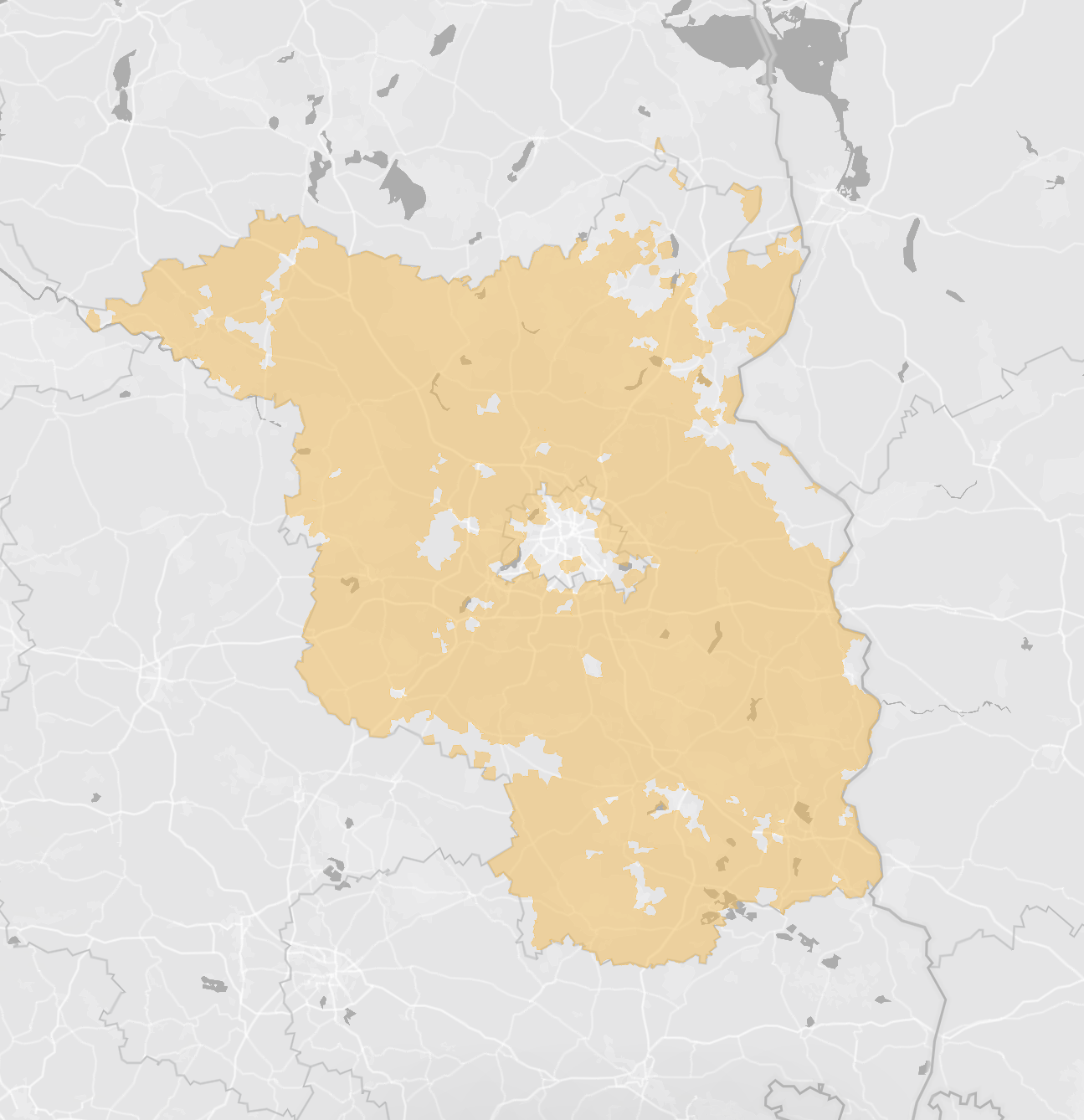
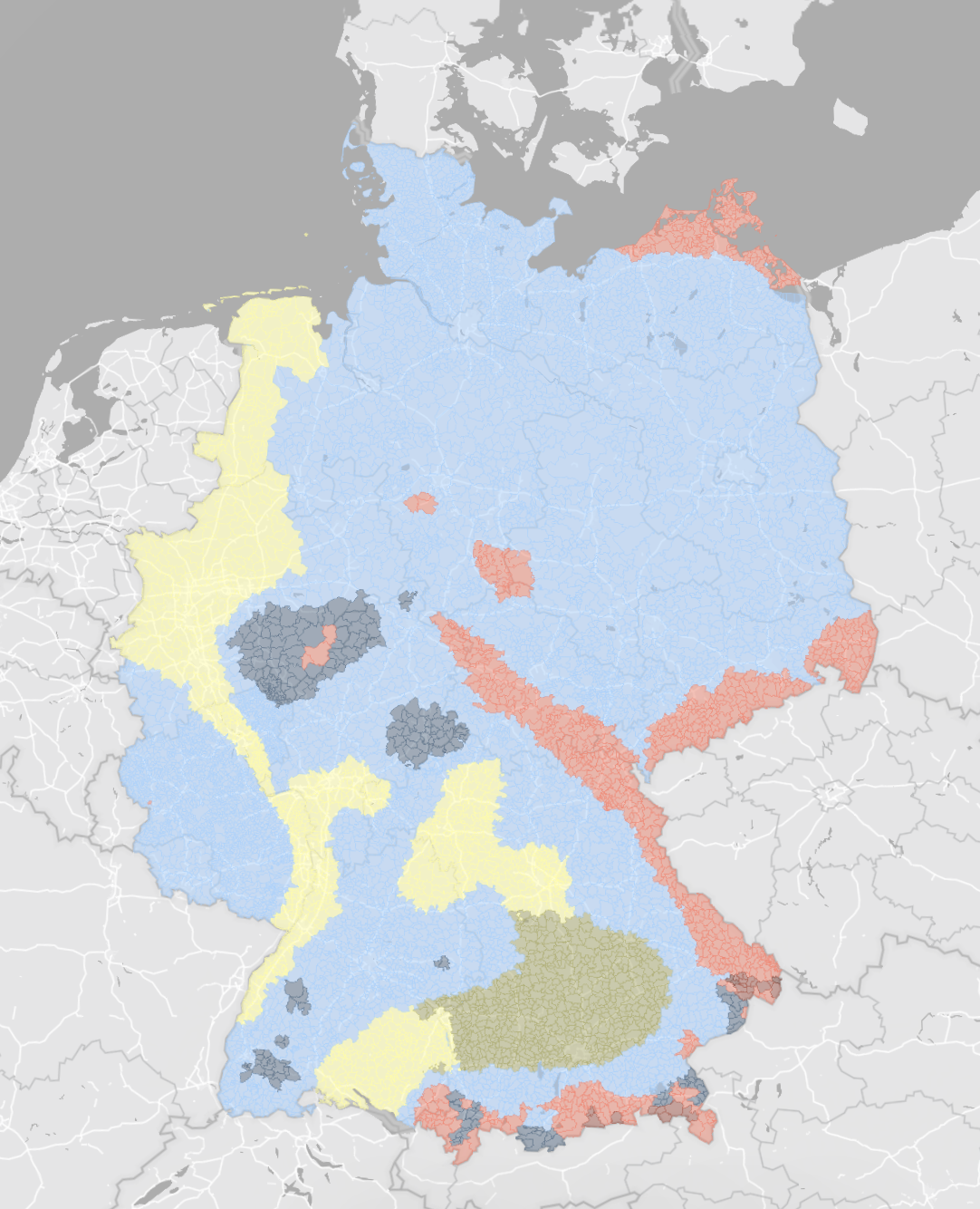
Disadvantaged areas
In many German federal states, including Schleswig-Holstein, Brandenburg, Hesse, Bavaria, and Baden-Württemberg, disadvantaged areas are important for planning renewable energy projects, especially regarding eligibility and site evaluation. While we utilize available vector data for most regions, our team manually digitized the layer for Schleswig-Holstein directly from the defining 1986 European directive to ensure complete and accurate coverage.
The ability to identify these areas early and reliably is crucial for the economic assessment of a project. At Glint Solar, the necessary layers are readily available and can be easily incorporated into site analyses.
 Source: Glint Solar - Layer: “BB: Agriculturally disadvantaged areas” (©MLUK)
Hydrogen core network (nationwide)
The approved hydrogen core network is a key piece of infrastructure supporting the energy transition. Being close to future customers and energy infrastructure is becoming increasingly important when planning renewable projects. To make this data easily accessible, our team custom-digitized the approved routes into a continuous spatial layer.
This nationwide map of the hydrogen core network helps developers spot potential synergies between renewable power and hydrogen early in the project lifecycle. It's designed to be clear, practical, and easy to use without adding unnecessary complexity.
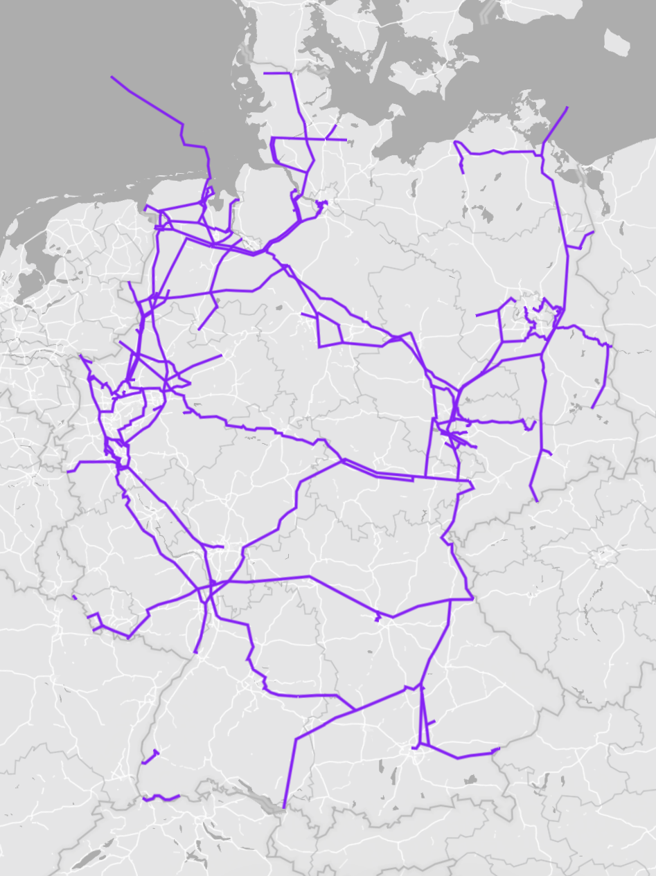 Source: Glint Solar - Layer: “Hydrogen core network” (Bundesnetzagentur)
Identifying responsible distribution network operator
Those involved in project development are familiar with the question of which distribution network operator is responsible for a given location.
At Glint Solar, this information can be accessed directly for a selected site (right click on the map → "Open in VNB"). There is no need for external research or switching between tools. This small functionality can make a noticeable difference in day-to-day project work.
 Source: Glint Solar; Glint Solar - Layer: “DEU: Parcels” (AdV)
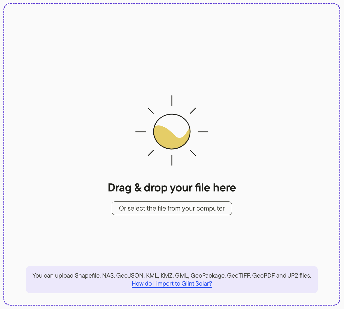
Importing NAS files
Many relevant cadastral and geospatial datasets in Germany are provided in NAS format and are integral to established workflows.
These datasets can be uploaded directly into Glint Solar and used within the platform. This allows existing data foundations to be seamlessly integrated into digital project planning, eliminating the need for additional conversion steps. In the German market especially, this functionality is key for connecting existing processes with modern planning tools.
Source: Glint Solar
Snow and Wind Load Zones (nationwide)
Snow and wind loads are critical technical planning factors for renewable energy installations, significantly influencing the design and dimensioning of system components, foundations, and supporting structures.
To build these comprehensive layers for Germany, we translated the official tabular assignments from the Deutsches Institut für Bautechnik (DIBt) into a seamless spatial dataset by mapping their municipal classifications to current administrative boundaries.
Providing realistic, site-specific initial assessments, these layers help project planners take load requirements into account early on. This enables a better assessment of potential risks at the concept stage, with an emphasis on clarity and direct applicability within the context of any project area.
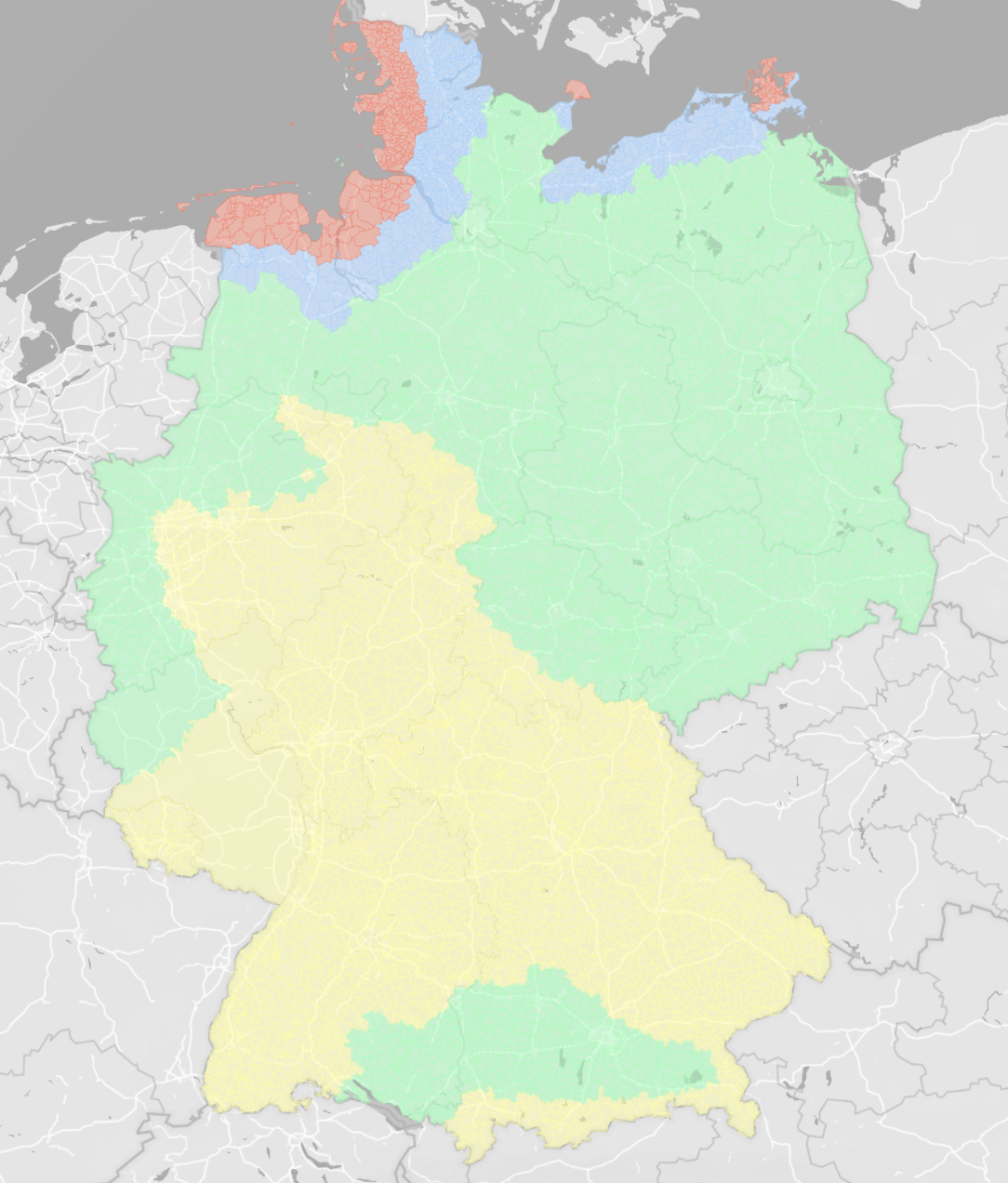 Source: Glint Solar - Layer: “DEU: Snow load zones” (DIBt) Source: Glint Solar - Layer: “DEU: Wind load zones” (DIBt)
Layers built from real world use
All of our layers are built with practical application in mind. A significant portion of the data and its preparation is developed from us with a clear focus on usability, clarity, and relevance to real-world projects.
Along with official open data, we continuously invest in our product by licensing specialized datasets to meet our customers\' specific needs and become the single-source of truth for developers. A few practical examples of this include:
- Bavarian parcels
- WMS DOP 20 cm (high-resolution digital orthophotos)
- DEM (Digital Elevation Models)
We work closely with our customers to continuously improve Glint Solar, ensuring the platform evolves according to the actual needs of renewable energy project development.
Beyond our pre-built data, you can easily import your own files, such as Shapefile, GeoJSON, KML, NAS files or GeoTIFF, as custom layers or projects. With just a few clicks, you can add essential information for site selection, combine it with existing filters, and edit it securely, knowing that your imported layers remain strictly private to your organization.
Interested in learning more about our platform and its data?