
Buildable land revealed in minutes
-
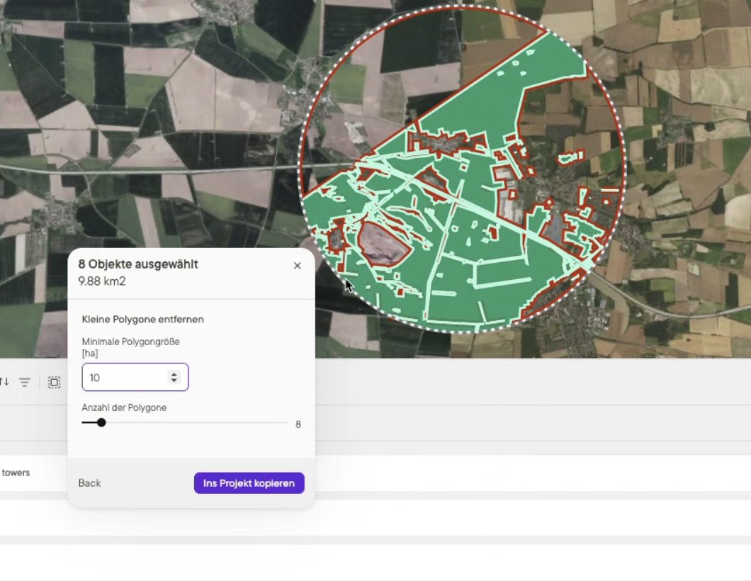
One-click action
Instead of drawing shapes by hand or toggling endless layers, you define your rules once and run a calculation in one click.
Define your build rules once and instantly generate reliable Buildable Area and Area Insights reports, giving you clarity, speed, and confidence in every decision.
Go/no-go decisions without hours of manual checks.
Instead of drawing shapes by hand or toggling endless layers, you define your rules once and run a calculation in one click.

Every team screens land differently. Some want to avoid steep slopes, others buffer wetlands or stay clear of protected zones.
Buildable Area adapts to your approach so the results reflect your own development strategy, not a generic template.

Constraints don’t stay fixed. Wetlands, forests, or planning zones can shift over time.
When new data is published, simply re-run Buildable Area to refresh the footprint.
That way, you keep projects on track without restarting the entire evaluation.

